
This last Monday I did a long out-and-back run through EBMUD lands from Redwood Road (near Lake Chabot) out to the edge of Las Trampas Regional Wilderness along the Ramage Peak Trail.
I should file this under “Epic Runs of 2012”. Here’s a map:
http://www.ebmud.com/sites/default/files/pdfs/south%5B1%5D.pdf
EBMUD is the East Bay Municipal Utilities Division, it’s where us East Bayers get our water from- they manage most of the lands east of the hills separating the cities (Oakland, Berkeley, Hayward, etc.) from the exurbs (Lafayette, Walnut Creek, Danville, etc.). There’s about 27,000 acres of land under their jurisdiction and another 112,000 acres that the EBRPD (East Bay Regional Parks Department) manages. There’s a ton of open space out there, with miles and miles of trails.
Here’s some pictures to give you an idea of what we’re working with:


These are pics of the main (or first) canyon meadow, one is looking back on the trail head area and the next is after you’ve gone through a little stretch of shaded single track.
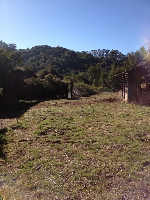
Then you come to this abandoned barn.


I thought this place was kinda creepy, maybe it was the steam everywhere from the melting frost.
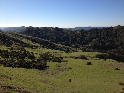
Then there were miles of view, over the next section of shaded single track up over another canyon wall:


The first is looking east, towards the ridge. The second is looking back towards the San Leandro Reservoir.

Here’s the view up the side of Ramage Peak, it was like going up a carpet, a shelf of grassy switchbacks.
Here’s a view back towards the Bay from Ramage Peak. I had been running for about 2 hours at this point.

So after about another hour of running, I finally hit the Rocky Ridge at the edge of Las Trampas Wilderness, here’s the final assault up the last climb.

Brutal…

…which led to the rewarding view from the top.

That’s me, on the top of the first rocks of this “Rocky Ridge”. I wish I knew I’d need my mountain climbing skills, my legs were shot trying to climb back down.

I’m happy as a clam but also a little freaked out, I had to climb up here:

(thinking about joining a climbing gym…)
And here’s a view of the ridge going north:

You can see the line of uplift, sort of like the Flatirons of Colorado (except these here are buried under 30 million years of sediment and Earth*)
* – not a geologist, so I’m probably not authorized to say anything like this
Anyway, by the time I turned around right here it had been 3 hours 11 minutes, and I wanted to charge back really hard. I did the return in 2:14, and save for all the sightseeing stuff it was probably 2:50 out.
Here’s the stats:
20.4 miles
5:25:56
+7480 feet of climbing
I ran out of Gu and water about 45 minutes from the end, got kind of bonky there. I made the decision that if I was going to blow up, I was going to do it in fantastic style, so once I hit the “2.9 miles to Chabot Staging Area” marker I was determined to get back in 29 minutes (my ego decided 10 minute miles at this point was the best I could do), so I motored back and made it to the trail head in…
…29:10, just missing my goal. I was as hurting as I’ve ever been on a training run, and every second was worth it.
